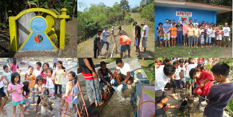
I spent ten days living in Apatut, a small farming community in Balaoan, a municipality within the province of La Union, about 300 km northwest of Manila. Michael Baker Jr., Inc. sponsored me to travel to the Phillippines for EWB-MAP (Engineers without Borders Mid-Atlantic Professionals) to oversee well drilling and to prepare for later design stages of the project. The first phase of the project includes building a water supply tank, installing water treatment, and community tapstands. The second phase of design will be to extend the water supply line to the school and to each household. EWB-MAP plans to provide potable drinking water for approximately 750 residents and 300 school children who attend public school in Apatut. The primary goal of the trip was to oversee the drilling of a well down to a deep aquifer to provide the community with clean water at a sufficient flow rate to meet daily demand. All of the existing wells are only about 35 to 40 feet deep, pulling water from a shallow, contaminated aquifer. Many of the residents experience illness such as dysentery, diarrhea, and stomachache due to the poor quality of their drinking water. For now, they must boil water or buy bottled water in order to avoid contamination and illness.
Ed Jakubowski, another volunteer and a geologist with ERM, and I stayed in Robert Osoteo’s family house in Apatut. Robert along with Edgardo Ayaquil helped to start the Water for Life project with EWB in 2007. Robert’s parents were farmers and raised him and his siblings in the village. Though Robert and his wife and children live in Canada, he comes back to the Philippines each year to visit family and to progress the water project.
For seven days, I visited the drill site each morning and evening to check on progress and to evaluate the soil samples taken at each meter of depth. The drill bit reached 100 meters during the second week of the trip. The following day, resistivity testing was performed to determine whether there was any hope of the well producing water. Disappointingly, the well was found to be dry, made up of 100m of clay and shale layers. The hardest part of the trip was meeting with the community leaders and seeing the disappointment on their faces as the team shared the outcome of the drilling. However, Ed and I reassured them that the EWB-MAP team was by no means giving up, and that we’d back with another plan in search for water.
When it was determined that the proposed well would not provide an adequate water supply, additional data collection was initiated. Over the last two days, the team surveyed all of the existing wells in the community, going door to door to speak with the families that own the wells. While some sectors of the village have wells for each household, there are large sections of town where the homeowners do not have individual wells on their property, and must share nearby wells with their neighbors. Although some of this data was previously collected during the project assessment trip, the level of detail was increased to include collection of GPS coordinates, owner name, year built, well yield, etc.
Also while in Apatut, we collected GPS data for the main supply trunk-line run along the main road as well as at the proposed water storage tank site, and proposed access road. We met with potential masons, obtained price quotes for materials to construct the water storage tank, and estimated the quantities needed for a smaller version of the tank that will be built to practice ferrocement construction techniques before building the full-size version for the project.
The EWB-MAP team plans to re-evaluate potential well-drilling sites in the village or other potential water sources in the project vicinity and gather additional geologic information for the area. All of the data collected from the trip will be processed and used to create a map of the area. The driller proposed to perform resistivity testing in the village to determine the next drilling location, however these tests can produce false positives thus are not foolproof. More sophisticated testing could be helpful for finding the best location to drill, however such tests can be expensive and may require skilled individuals to volunteer. Though the results of the drilling were unsuccessful, there are many other ways to approach the water problem in Apatut. Engineers are problem solvers, and are trained to persevere even when an immediate or easy solution is not at hand.


